
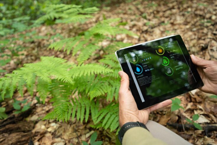
The challenges facing the natural world have never been more acute and artificial intelligence (AI) is helping to drive forward a step-change in both research practice and outcomes.
The benefits are widespread, including:
- more effective nature-based solutions
- wildlife monitoring and natural hazard identification
- improvements in biodiversity
- more productive businesses
- saving lives and money
- increasing resilience
Unprecedented scale
By using machine learning and state-of-the-art sensors (deployed on everything from satellites to microscopes) environmental data is being delivered at unprecedented scale and detail.
Moreover, AI algorithms are making it possible to rapidly analyse multiple data sources. This results in more accurate and timely predictions of longer-term environmental change (in areas such as climate and biodiversity) as well as in relation to more immediate hazards such as storms and harmful algal blooms.
These developments are supported by Natural Environment Research Council (NERC) and UK Research and Innovation (UKRI) strategic investments in unique datasets, skilled people and compute infrastructure.
The work contributes to a number of:
- UKRI strategic themes
- UN Sustainable Development Goals
- Areas of Research Interest of the Department for Environment, Food and Rural Affairs, Department for Science, Innovation and Technology, and Department for Transport
Resilience to earthquakes and volcanoes
Machine learning is speeding up disaster relief, helping governments and humanitarian organisations save lives and reduce suffering.
Automatic large-scale processing of satellite data enables rapid modelling of earthquakes and volcanic activity, providing actionable information within a few hours, whereas previous methods took days.
The service is provided by a NERC research centre, the Centre for Observation and Modelling of Earthquakes, Volcanoes and Tectonics (COMET) using the JASMIN supercomputer.
Example outcomes
Enabling faster, more effective disaster relief: Türkiye-Syria (2023) and New Zealand (2020) earthquakes, Icelandic eruptions (2020, 2014 to 2015).
Business growth: University of Leeds spin-out, SatSense (established in 2018) has provided the services commercially to clients including Network Rail, United Utilities and the National Highways Agency.
Forward look
Over 200 million people live near volcanoes, whose activity can change unexpectedly. A University of Leeds-led team is seeking to use machine learning to forecast volcanic activity more accurately using satellite data.
A Centre for Doctoral Training (University of Cambridge-led) is developing an AI-forecasting tool for slow earthquakes.
Reducing the impact of flooding
AI is making infrastructure, businesses and communities more resilient to the impacts of flooding.
University of Bristol spin-out company Fathom uses machine learning algorithms to fill in data gaps in its global flood and climate risk models. This improves forecast accuracy, including for regions without detailed historical data.
Example outcomes
Business growth: Fathom now employs over 50 people, has an annual turnover of £4 million and was recently acquired by international reinsurance company Swiss Re.
Reduced business risk: accurate flood risk mapping enables companies to more effectively plan infrastructure, price products and manage flood response. Fathom’s customers include Microsoft cloud infrastructure (worth $15 billion, used by over 400 million people) and global insurance companies who provide flood risk insurance on assets worth $1.35 trillion.
Support for the most vulnerable: enabling more effective disaster response and infrastructure planning in climate-vulnerable countries through partnerships with the World Bank and UK Foreign, Commonwealth and Development Office.
Conserving wildlife from space
A system that uses image recognition from satellites is delivering more accurate and wide-ranging conservation analysis compared to traditional survey methods, allowing more targeted and cost-effective action to protect endangered wildlife.
The approach is also more sustainable for the planet, safer for researchers and non-invasive for the animals.
Developed by the NERC British Antarctic Survey (BAS) and partners, it is now being used by governments and conservation organisations across the world.
Example outcomes
Conservation status of emperor penguin: more accurate population data led to status being upgraded from ‘Least Concern’ to ‘Near Threatened’. Find out more in BAS’s evaluation of NERC centres evidence submission.
International conservation organisations use this to monitor vulnerable species including albatrosses, seals and whales. Find out more in BAS’s evaluation of NERC centres evidence submission.
Citizen science: BAS and WWF recruited 26,000 people to validate 500,000 satellite images of walrus populations.
Forward look
BAS is working with The Alan Turing Institute, Met Office and Science and Technology Facilities Council. They are exploring new ways of combining data from satellite and in-situ surface sensors to help improve our understanding of the changing polar environment.
Navigating a changing polar climate
AI-enabled forecasting tool ‘IceNet’ is saving time, money and reducing carbon emissions. The tool rapidly analyses climate simulations alongside long-term satellite imagery to deliver forecasts of changing sea ice cover up to six months in advance.
Developed by BAS and The Alan Turing Institute, IceNet is faster and more accurate than traditional models, particularly for extreme ice-loss events.
Example outcomes
Optimising research vessel route planning by streamlining journey times, the tool has reduced BAS’s operating costs and carbon emissions.
Forward look
BAS is developing a tool that will use AI and satellite data to track the changes in numbers, size and pathways of icebergs, to support safer ship navigation and research into rising sea levels.
BAS is working with partners in Canada to use IceNet to predict when endangered caribou will migrate across sea ice, enabling authorities to warn ship operators and adapt conservation activities.
Understanding biodiversity health
Image recognition technology is delivering autonomous, continuous, detailed and unbiased data at scale, saving money and enabling more effective action on biodiversity.
The Automated Monitoring of Insects (AMI) device has been developed by the UK Centre for Ecology and Hydrology (UKCEH) and is enabling government, businesses, communities and scientists to make better informed decisions.
Example outcomes
Measuring the impact of land management initiatives: AMI devices are measuring the biodiversity impacts of different peatland restoration and agri-environment interventions in real-time, providing detailed evidence that will inform our journey to net zero.
Supporting biodiversity action across the world: UKCEH and The Alan Turing Institute are deploying AMI, with additional sound recognition capability, to baseline small animal populations (for example, insects, bats and birds) in Africa, Asia and South America.
Making trackside vegetation management cheaper and safer with Keen AI Ltd, using similar technology to identify invasive and diseased plants from moving trains for Network Rail, one of the UK’s biggest landowners. The work also provided the baseline for Network Rail’s biodiversity strategy.
Empowering biodiversity action
University of East Anglia spin-out company NatureMetrics is using machine learning in conjunction with satellite observations to fill in gaps and uncertainties in environmental DNA data. It is creating realistic estimates of animal, bacteria and fungi populations and enabling tracking of biodiversity changes over time.
Example outcomes
Businesses, researchers and charities are using this bioinformatics tool to improve environmental management practices worldwide and to meet growing environmental regulatory and legislative requirements. Read NatureMetrics’ success stories:
- innovative fish eDNA project launched at offshore wind farm
- uncovering the recovering biodiversity along the Sussex coast
- tracking and reviving the critically endangered European eel using eDNA
Unilever, for example, has partnered with NatureMetrics to measure soil and insect biodiversity in supply chain farms in Argentina, Canada, the UK and Europe, supporting its move to more climate-resilient farming.
Forward look
NatureMetrics is working with partners to test methods to quantify biodiversity, to enable organisations to offset their environmental impact by investing in biodiversity credits governed by standards.
Supporting coastal economies
An AI-enabled alert system is saving the UK fish farming industry millions by increasing its productivity.
The tool is developed by Plymouth Marine Laboratory (PML) and partners. It uses machine learning to analyse ocean colour data from satellites in conjunction with weather data (for example, wind, rain and temperature) to provide earlier and more detailed harmful algal bloom (HAB) alerts.
Example outcomes
Improved early warning system: the new system covers the entire English Channel for £37,000 each year, significantly enhancing the established £2 million-a-year system which covers only 6% of the channel.
Increased productivity of the UK shellfish industry: HABs can produce toxins in shellfish fatal to humans if eaten. Accurate early warnings enable companies to suspend and restart harvesting at the right times. Historically, the South West’s £7 million shellfish industry has lost an estimated £2.5 million annually to HAB contamination.
Forward look
PML is developing a digital twin for HAB monitoring, combining observation data and marine system models to produce an agile framework that will support research, policy and commercial applications.
Understanding changing marine ecosystems
Image recognition is improving our understanding of ocean health, supporting climate and biodiversity action.
Using automated imaging and classification technology, PML is delivering almost continuous plankton monitoring, compared to the long-established weekly sampling. It is enhancing the 30-year plankton dataset from the Western Channel Observatory (WCO) near Plymouth.
Example outcomes
International understanding of environmental change: WCO is one of the world’s longest marine time series; used in international assessments to underpin climate and biodiversity action by providing a window on ocean and climate health.
Observing short-term changes for the first time: by resolving sub-daily changes in plankton populations, the new capability delivers early warnings of threats to marine industries and ocean health, including the emergence of invasive species and HABs.
Forward look
PML is developing software to allow group-collaboration on classifying marine image data, as well as technology to detect invasive Pacific oysters from drone footage and floating plastic litter from ship-mounted cameras.
Uncovering the depths of the seafloor
An AI-enabled camera system is unlocking a treasure trove of new information for marine industries, governments, conservation organisations and researchers.
BioCam uses machine learning to produce high-detail, 3D colour images of underwater structures.
Developed by the University of Southampton, BioCam can produce detailed maps of up to 80 acres of seafloor a day: 40 times faster than conventional imaging systems.
Example outcomes
Monitoring recovery of Scottish Marine Protected Areas after bottom-trawler fishing was halted, in partnership with the National Oceanography Centre.
Surveying ‘end-of-life’ oil rigs off the Shetland Islands: attached to the ‘Boaty McBoatface’ Autosub, assessing the value of preserving decommissioned structures as artificial sea-life havens.
Commercial use: the technology has been licensed to Voyis Imaging, Canadian underwater survey specialists who work with the science, offshore energy, defence and civil infrastructure sectors.
Sustainable Development Goals
These projects contribute to many UN Sustainable Development Goals including:
- 3: good health and wellbeing
- 9: industry, innovation and infrastructure
- 10: reduced inequalities
- 11: sustainable cities and communities
- 12: responsible consumption and production
- 13: climate action
- 14: life below water
- 15: life on land